Supporting SFI Success with ClearSky Imagery
[/et_pb_text][/et_pb_column][/et_pb_row][/et_pb_section][et_pb_section fb_built=”1″ custom_padding_last_edited=”on|desktop” admin_label=”Section” _builder_version=”4.16″ background_color=”#f7f7f4″ custom_padding_tablet=”50px|0|50px|0″ custom_padding_phone=”” da_disable_devices=”off|off|off” transparent_background=”off” padding_mobile=”off” make_fullwidth=”off” use_custom_width=”off” width_unit=”on” global_colors_info=”{}” da_is_popup=”off” da_exit_intent=”off” da_has_close=”on” da_alt_close=”off” da_dark_close=”off” da_not_modal=”on” da_is_singular=”off” da_with_loader=”off” da_has_shadow=”on”][et_pb_row column_structure=”1_3,2_3″ padding_mobile=”on” column_padding_mobile=”on” admin_label=”row” _builder_version=”4.16″ background_size=”initial” background_position=”top_left” background_repeat=”repeat” custom_padding=”0px||0px|||” make_fullwidth=”off” use_custom_width=”off” width_unit=”on” global_colors_info=”{}”][et_pb_column type=”1_3″ _builder_version=”4.16″ custom_padding=”|||” global_colors_info=”{}” custom_padding__hover=”|||”][et_pb_text admin_label=”Text” _builder_version=”4.16″ text_font=”PT Sans||||” text_text_color=”#323232″ text_font_size=”10em” text_line_height=”1.1em” background_size=”initial” background_position=”top_left” background_repeat=”repeat” custom_margin=”0px||0px|” use_border_color=”off” border_color=”#ffffff” border_style=”solid” global_colors_info=”{}”]11
[/et_pb_text][et_pb_divider color=”#aeaeac” admin_label=”Divider” _builder_version=”4.16″ custom_css_main_element=”width:20px;” hide_on_mobile=”off” global_colors_info=”{}”][/et_pb_divider][et_pb_text admin_label=”Text” _builder_version=”4.17.3″ text_font=”PT Sans|on|||” text_text_color=”#363636″ text_font_size=”18″ background_size=”initial” background_position=”top_left” background_repeat=”repeat” custom_margin=”-10px||0px|” use_border_color=”off” border_color=”#ffffff” border_style=”solid” global_colors_info=”{}”]NOVEMBER, 2024
[/et_pb_text][et_pb_text admin_label=”Text” _builder_version=”4.17.3″ text_font=”PT Sans||||” text_text_color=”#02b875″ background_size=”initial” background_position=”top_left” background_repeat=”repeat” custom_margin=”20px|||” use_border_color=”off” border_color=”#ffffff” border_style=”solid” global_colors_info=”{}”]News
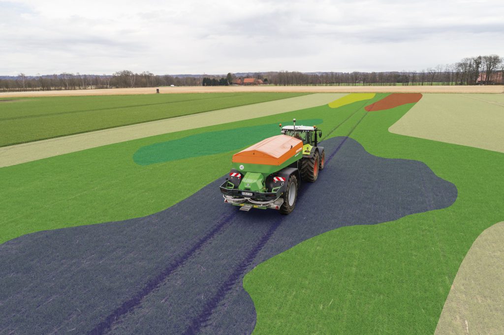
[/et_pb_text][/et_pb_column][et_pb_column type=”2_3″ _builder_version=”4.16″ custom_padding=”|||” global_colors_info=”{}” custom_padding__hover=”|||”][et_pb_text admin_label=”Text” _builder_version=”4.16″ text_font=”PT Serif||||” text_text_color=”#363636″ text_font_size=”24″ text_line_height=”1.4em” background_size=”initial” background_position=”top_left” background_repeat=”repeat” max_width=”620px” custom_margin=”10px||0px|” custom_padding=”||0px|||” text_font_size_tablet=”” text_font_size_phone=”” text_font_size_last_edited=”on|tablet” use_border_color=”off” border_color=”#ffffff” border_style=”solid” global_colors_info=”{}”]The use of data from soil analysis carried out in previous seasons is sufficient for variable rate lime and P and K applications, as pH values and soil indices typically do not change significantly during the season. However, this is not the case for variable rate nitrogen.
[/et_pb_text][et_pb_text admin_label=”Text” _builder_version=”4.16″ text_font=”PT Serif||||” text_text_color=”#363636″ text_font_size=”20″ text_line_height=”1.5em” background_size=”initial” background_position=”top_left” background_repeat=”repeat” max_width=”620px” custom_margin=”30px||0px|” text_font_size_tablet=”” text_font_size_phone=”” text_font_size_last_edited=”on|tablet” use_border_color=”off” border_color=”#ffffff” border_style=”solid” global_colors_info=”{}”]Nitrogen requirements depend on the crop situation and the available soil reserves following winter. Therefore, the PRF1 action stipulates that when remote sensing is used to calculate the nitrogen requirement, it must be carried out no more than 14 days prior to application.
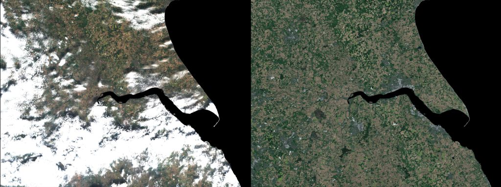
The above-average rainfall and heavy cloud cover during spring 2024 meant that those relying on optical imagery from the Sentinel-2 satellites struggled to obtain images of sufficient quality to meet the PRF1 action. Around 80% of the imagery produced was rejected.
[/et_pb_text][/et_pb_column][/et_pb_row][et_pb_row padding_mobile=”on” column_padding_mobile=”on” custom_padding_last_edited=”on|tablet” admin_label=”Row” _builder_version=”4.16″ background_size=”initial” background_position=”top_left” background_repeat=”repeat” min_height=”493.4px” custom_margin=”|auto|-63px|auto||” custom_padding=”50px|||” custom_padding_tablet=”17px|||” custom_padding_phone=”” make_fullwidth=”off” use_custom_width=”off” width_unit=”on” global_colors_info=”{}”][et_pb_column type=”4_4″ _builder_version=”4.16″ custom_padding=”|||” global_colors_info=”{}” custom_padding__hover=”|||”][et_pb_image src=”https://www.rhizadigital.co.uk/wp-content/uploads/2024/11/Lime-planner.png” title_text=”Lime planner” show_bottom_space=”off” align_tablet=”center” align_phone=”” align_last_edited=”on|desktop” admin_label=”Image” _builder_version=”4.17.3″ animation_style=”fade” animation_duration=”500ms” use_border_color=”off” border_color=”#ffffff” border_style=”solid” animation=”fade_in” sticky=”on” always_center_on_mobile=”on” global_colors_info=”{}”][/et_pb_image][et_pb_text admin_label=”Text” _builder_version=”4.17.3″ text_font=”PT Serif||on||” text_text_color=”#363636″ text_font_size=”16″ text_line_height=”1em” background_size=”initial” background_position=”top_left” background_repeat=”repeat” custom_margin=”20px||0px|” use_border_color=”off” border_color=”#ffffff” border_style=”solid” global_colors_info=”{}”]Soil pH values can be displayed as a list and colour-coded map in RHIZA Lime Planner
[/et_pb_text][/et_pb_column][/et_pb_row][et_pb_row padding_mobile=”on” column_padding_mobile=”on” admin_label=”row” _builder_version=”4.16″ background_size=”initial” background_position=”top_left” background_repeat=”repeat” min_height=”265px” custom_padding=”0px||12px|||” make_fullwidth=”off” use_custom_width=”off” width_unit=”on” global_colors_info=”{}”][et_pb_column type=”4_4″ _builder_version=”4.16″ custom_padding=”|||” global_colors_info=”{}” custom_padding__hover=”|||”][et_pb_text admin_label=”Text” _builder_version=”4.16″ text_font=”PT Serif||||” text_text_color=”#363636″ text_font_size=”20″ text_line_height=”1.5em” background_size=”initial” background_position=”top_left” background_repeat=”repeat” max_width=”620px” custom_margin=”30px||0px|” custom_padding=”||33px|||” text_font_size_tablet=”” text_font_size_phone=”” text_font_size_last_edited=”on|tablet” use_border_color=”off” border_color=”#ffffff” border_style=”solid” global_colors_info=”{}”]The only source of guaranteed cloud-free imagery that meets the SRF1 action requirements is ClearSky. It provides high accuracy through full-spectrum optical and infrared imagery, including NDVI and GCVI from synthetic-aperture radar (SAR) – see Figure 4. Unlike Sentinel-2, SAR imagery does not require a clean line of sight and is unaffected by cloud cover.
[/et_pb_text][et_pb_image src=”https://www.rhizadigital.co.uk/wp-content/uploads/2024/11/CS-march-24.png” title_text=”CS march 24″ show_bottom_space=”off” align_tablet=”center” align_phone=”” align_last_edited=”on|desktop” admin_label=”Image” _builder_version=”4.17.3″ min_height=”322.4px” animation_style=”fade” animation_duration=”500ms” use_border_color=”off” border_color=”#ffffff” border_style=”solid” animation=”fade_in” sticky=”on” always_center_on_mobile=”on” global_colors_info=”{}”][/et_pb_image][et_pb_text admin_label=”Text” _builder_version=”4.17.3″ text_font=”PT Serif||on||” text_text_color=”#363636″ text_font_size=”16″ text_line_height=”1em” background_size=”initial” background_position=”top_left” background_repeat=”repeat” custom_margin=”20px||0px|” use_border_color=”off” border_color=”#ffffff” border_style=”solid” global_colors_info=”{}”]A ClearSky image showing NDVI values needed to support a variable rate application file
[/et_pb_text][/et_pb_column][/et_pb_row][et_pb_row padding_mobile=”on” column_padding_mobile=”on” admin_label=”row” _builder_version=”4.16″ background_size=”initial” background_position=”top_left” background_repeat=”repeat” custom_margin=”-20px|auto||auto||” custom_padding=”17px|||” make_fullwidth=”off” use_custom_width=”off” width_unit=”on” global_colors_info=”{}”][et_pb_column type=”4_4″ _builder_version=”4.16″ custom_padding=”|||” global_colors_info=”{}” custom_padding__hover=”|||”][et_pb_text admin_label=”Text” _builder_version=”4.17.3″ text_font=”PT Serif||||” text_text_color=”#363636″ text_font_size=”20″ text_line_height=”1.5em” background_size=”initial” background_position=”top_left” background_repeat=”repeat” max_width=”620px” min_height=”635px” custom_margin=”30px||0px|” text_font_size_tablet=”” text_font_size_phone=”” text_font_size_last_edited=”on|tablet” use_border_color=”off” border_color=”#ffffff” border_style=”solid” global_colors_info=”{}”]This breakthrough technology ensures that farmers using ClearSky receive crop development imagery every six days, regardless of weather conditions, as SAR data is not hindered by clouds. Unlike other ‘cloud-free’ solutions, ClearSky does not rely on sporadic clear optical imagery for calibration. This provides greater confidence in the data supplied to customers.
Analysis by Agrii, covering 900,000ha, revealed that the Sentinel-2 system produced an average of 13.3 clear images per farm in 2023. In comparison, the ClearSky platform increased this number to 60.8, which improves even further when including cloud-free images captured by Sentinel-2.
Adopting technology that enhances the performance and resilience of agriculture is a key objective of the SFI. Demonstrating compliance with its actions goes beyond a simple tick-box exercise. Participants are expected to show they are fulfilling the required actions on demand. In some cases, this means providing a report; in others, it requires producing the actual data used to fulfil the task. ClearSky ensures that variable rate applications align with crop needs while making it easier to demonstrate compliance with the PRF1 action.
[/et_pb_text][et_pb_image src=”https://www.rhizadigital.co.uk/wp-content/uploads/2024/11/ClearSky-comparison-over-the-River-Humber-scaled.jpg” title_text=”ClearSky comparison over the River Humber” show_bottom_space=”off” align_tablet=”center” align_phone=”” align_last_edited=”on|desktop” admin_label=”Image” _builder_version=”4.17.3″ min_height=”322.4px” animation_style=”fade” animation_duration=”500ms” use_border_color=”off” border_color=”#ffffff” border_style=”solid” animation=”fade_in” sticky=”on” always_center_on_mobile=”on” global_colors_info=”{}”][/et_pb_image][et_pb_text admin_label=”Text” _builder_version=”4.17.3″ text_font=”PT Serif||on||” text_text_color=”#363636″ text_font_size=”16″ text_line_height=”1em” background_size=”initial” background_position=”top_left” background_repeat=”repeat” custom_margin=”20px||0px|” use_border_color=”off” border_color=”#ffffff” border_style=”solid” global_colors_info=”{}”]Clearsky comparison over the River Humber
[/et_pb_text][/et_pb_column][/et_pb_row][/et_pb_section]